WRV01 Riparian woody removal vegetation survey on watershed N2B at Konza Prairie

Summary

Short name: 

WRV01

Abstract: 

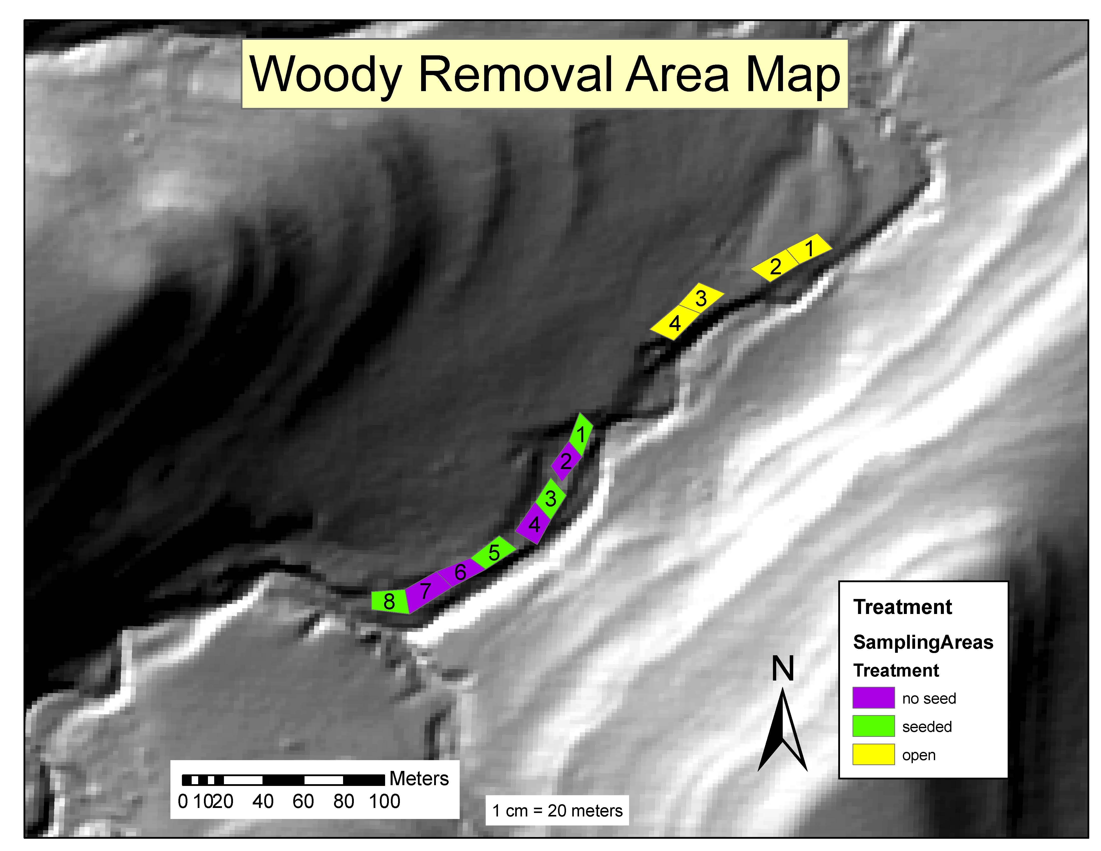
Woody vegetation within 30m of the stream channel was removed along the riparian corridor of watershed N2B in winter 2010. Thereafter, woody vegetation was recut every second or third year until 2020. Vegetation surveys were conducted before and after the initial removal (2010 and 2011) and again 10 years after the initial cutting (2020).

Published on EDI/LTER Data Portal

Citation Suggestion: 

Dodds, W. K., Carter, D. ., Taylor, J. . 2023. WRV01 Riparian woody removal vegetation survey on watershed N2B at Konza Prairie . Environmental Data Initiative. http://dx.doi.org/10.6073/pasta/4c92d80e56b1271d005069fc00c4d06d.

Data set ID: 

138

EML revision ID: 

3

Data sources: 

Variables: 

DataCode
  • Label:
  • Definition: Dataset code
  • Type: Nominal
  • Missing values: None specified
RecType
  • Label:
  • Definition: Record type
  • Type: Physical quantity
  • Unit: dimensionless
  • Maximum: Not specified
  • Minimum: Not specified
  • Precision: Not specified
  • Missing values: None specified
RecYear
  • Label:
  • Definition: Year of sample
  • Type: Physical quantity
  • Unit: Year (YYYY)
  • Maximum: Not specified
  • Minimum: Not specified
  • Precision: Not specified
  • Missing values: None specified
plot
  • Label:
  • Definition: Plot number from 1-12. plots are 1's (4 of these) and woody removal plots are 2's (8 of these)
  • Type: Physical quantity
  • Unit: dimensionless
  • Maximum: 12
  • Minimum: 1
  • Precision: 1
  • Missing values: None specified
transect
  • Label:
  • Definition: Transect number from 1-4.
  • Type: Physical quantity
  • Unit: dimensionless
  • Maximum: 4
  • Minimum: 1
  • Precision: 1
  • Missing values: None specified
subplot
  • Label:
  • Definition: subplot designation (1-8)
  • Type: Physical quantity
  • Unit: dimensionless
  • Maximum: Not specified
  • Minimum: Not specified
  • Precision: Not specified
  • Missing values: None specified
spcode
  • Label:
  • Definition: Species Code
  • Type: Physical quantity
  • Unit: dimensionless
  • Maximum: Not specified
  • Minimum: Not specified
  • Precision: Not specified
  • Missing values: None specified
gen
  • Label: gen
  • Definition: abbreviated genus
  • Type: Nominal
  • Missing values: None specified
spec
  • Label: spec
  • Definition: abbreviated specific epithet
  • Type: Nominal
  • Missing values: None specified
trt
  • Label:
  • Definition: Treatment refers to whether plots were open (so open to start with, no removal, no seeding), or treated with woody removal alone (not seeded), or treated with woody removal and seeded (seeded)
  • Type: Nominal
  • Missing values: None specified
coverclass
  • Label:
  • Definition: Canopy cover class: Percentage Range, midpoint Valueless than 0.5 for 0-1% canopy cover, and 62.5 for 50-75% canopy cover, 85 for 75-95% canopy cover, and 97.5 for 95-100% canopy cover. (see more from here- 1: 0-1, 0.5; 2: 1-5, 3 ; 3: 5-25, 15; 4: 25-50, 37.5; 5: 50-75, 62.5; 6: 75-95, 85; 7: 95-100, 97.5).
  • Type: Physical quantity
  • Unit: Percent
  • Maximum: 100
  • Minimum: 0
  • Precision: Not specified
  • Missing values: None specified
comment
  • Label:
  • Definition: Comments on data collection
  • Type: Nominal
  • Missing values: None specified

Categories
Dates

Date Range: 

Saturday, May 1, 2010 to Thursday, December 31, 2020

Publication Date: 

Tuesday, February 14, 2023
People

Owner/Creator: 

Contact: 

Additional Project roles: 

Role: 

Field Crew
Downloads